Fast & Reliable Earthwork Takeoffs – Powered by AGTEK
You can upload civil plans in PDF or CAD (DWG) format through the website contact form, or simply send a direct link to the documents. If available, you may also include a geotechnical or soil report.
Providing complete detail about scope of work allows our estimators to prepare a more accurate and comprehensive quantity takeoff and cost estimate.
Once we have your plans, our certified estimators review every detail — contours, grading limits, utilities, paving, and structures — to ensure full scope coverage.
Using AGTEK (industry-leading earthwork takeoff software), Planswift and Bluebeam, we calculate cut and fill volumes, topsoil handling, and material quantities with precision.
This combination of technology and experience ensures accurate and transparent results you can rely on for bidding and project management.
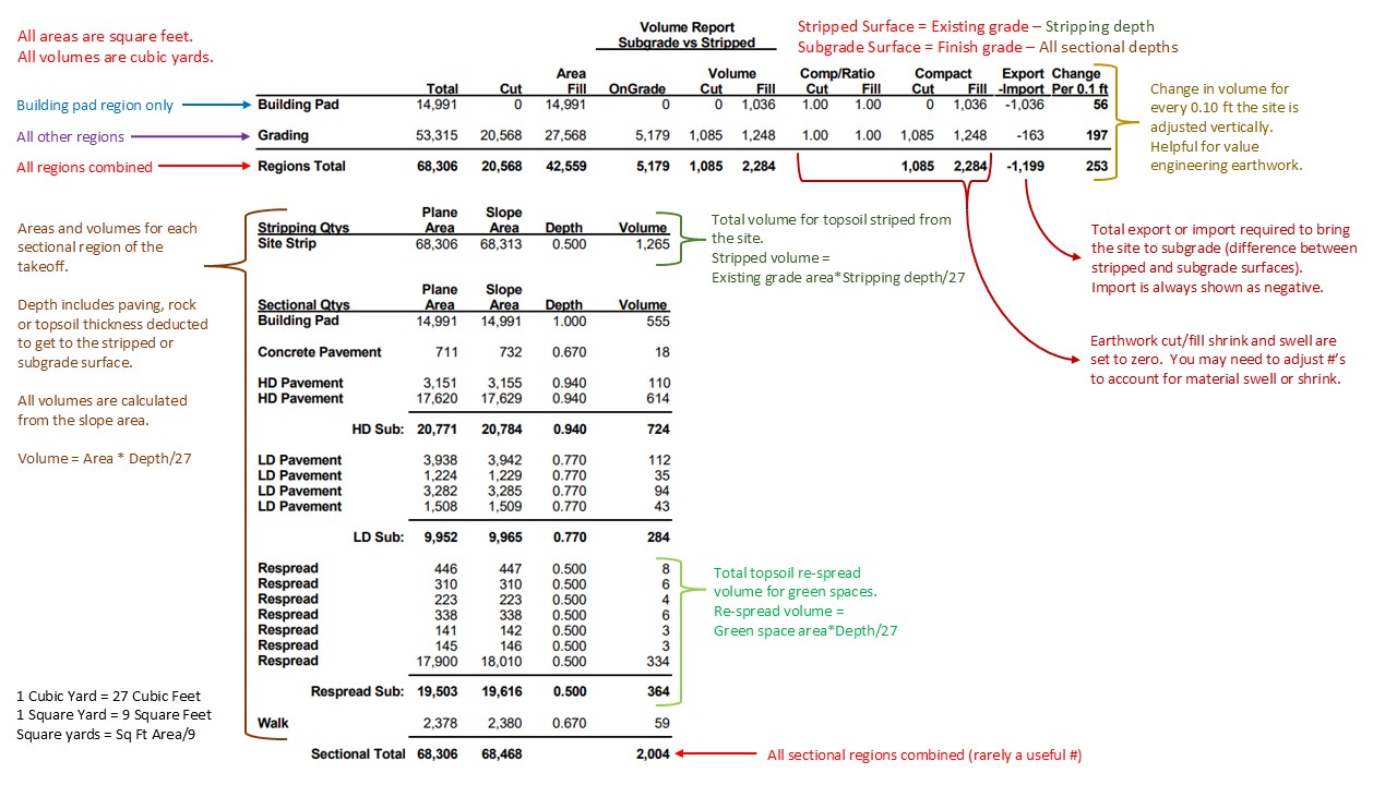
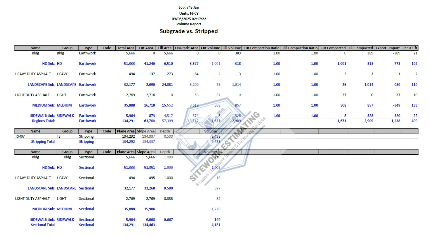
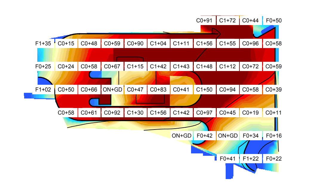
Quantifies total cut and fill volumes across the site based on comparison of existing and proposed surfaces. This is the core earthwork quantity deliverable, used for bidding, budgeting, and confirming material balance (import/export needs) before construction begins.
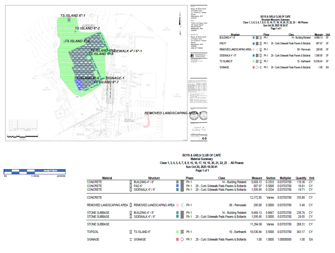
Full materials takeoff covering civil and sitework scopes — including aggregate base, subgrade materials, utility bedding and backfill (storm, sanitary, water), pipe and structure materials (RCP, HDPE, PVC, manholes, catch basins), pavement materials (asphalt, concrete, base course), curb and gutter, sidewalk and flatwork concrete, retaining wall materials, geotextile fabric and erosion control materials, striping and signage, and other bulk materials required for the project. Supports accurate procurement planning and cost estimation across civil and sitework construction.
Depth Bracket Summary, Trench Volume Report, Building Excavation Footer Report, Structure Measures Summary, Material Summary Report, Structure Measures Report, and Depth Bracket Report.
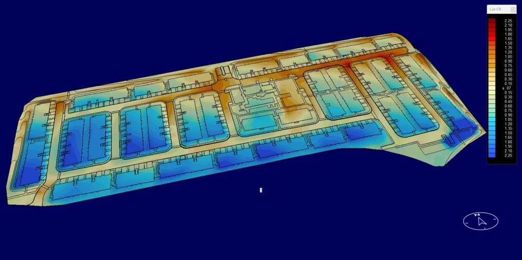
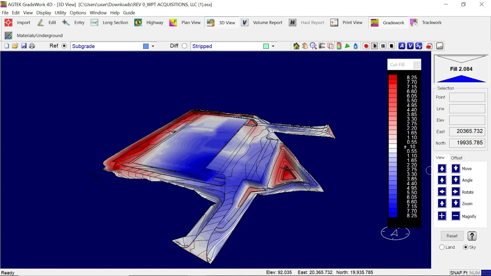
Complete 3D model (heat map) to support accurate earthwork takeoff, validation and clear communication of grading scope. This deliverable converts the project’s civil plans and survey data into a true 3D representation of the site, allowing stakeholders to visually understand grading intent and verify quantities with confidence.

Erosion and Sediment Control Report
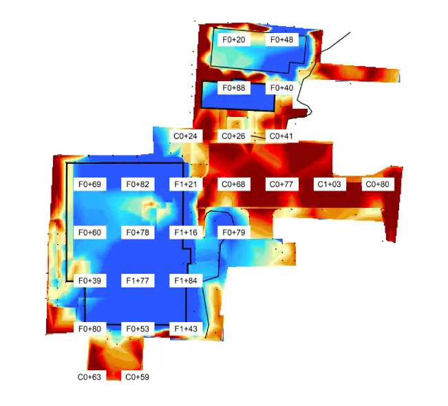
Our color-coded marked-up plans are delivered in PDF format for easy viewing, sharing, and team collaboration. Prepared using AGTEK, these drawings clearly highlight cut and fill areas, grading zones, utilities, and other sitework quantities directly on the project plans.
The visual color coding allows clients and contractors to quickly understand earthwork volumes, material quantities, and key site details, making the takeoff easier to review. This improves project coordination, bidding accuracy, and field execution by providing a clear visual reference alongside the detailed reports.
The 3D model of the site (Subgrade vs Stripped) generated using AGTEK provides a clear, color-coded visualization of earthwork. It highlights precise subgrade and stripped areas, helping contractors understand grading adjustments, balance cut and fill, and efficiently plan material movement across the site.
The 3D drive-through video, created using AGTEK software, provides an interactive visualization of the site’s existing and proposed grades. This realistic simulation allows you to virtually “drive” through the project and observe elevation changes, slopes, and grading details from a ground-level perspective.
It serves as a powerful tool for client presentations, project reviews, and internal planning, helping teams better understand the site layout and grading strategy. This visualization can also assist in identifying potential design or constructability issues early, before construction begins.